Speakers Biography & Abstract
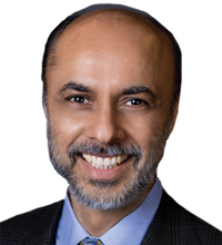
Bhupinder Singh
Senior Vice President, Bentley Systems, USA
About Speaker
Bhupinder joined Bentley in 1994 and is the Senior Vice President of Bentley Software. His team is responsible for the strategic direction, development and delivery of Bentley's industry leading software solutions for sustaining infrastructure. His prior roles at the company include managing director of sales for Bentley South Asia and senior vice president of the Platform Products Group. Prior to joining Bentley, Bhupinder held various software engineering positions at Montgomery Watson Hazra, Bell Labs and Intergraph Corporation. Bhupinder holds master's degrees in Computer Science from Rutgers University, Structural Engineering from Vanderbilt University, and a bachelor's degree in civil engineering from IIT Delhi. He also has a certificate in Management from the Wharton School of Business at the University of Pennsylvania.
About Presentation
Geospatial Technology: The Next Dimension
In this presentation Bhupinder Singh, Senior Vice President of Bentley Systems, will discuss evolving trends in geospatial technology including reality modelling, the convergence of GIS and BIM, subsurface utility engineering, and the increasing role of geospatial technology in asset performance modelling.
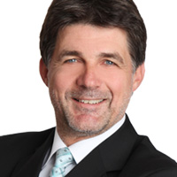
Johann JESSENK
Director Middle East, Russia, BeNeLux, Hexagon Geospatial EMEA, Austria
About Speaker
During his more than 20 years in the Geospatial industry Johann had the chance to work in several positions and areas. Graduated as a surveyor at the Technical University of Vienna he started his career in parallel with the electronic evolution of this industry, when computer science, we call this now "Geospatial", got involved and flooded engineering organizations. After a technical orientation he gradually moved into sales and marketing holding several management positions in his home country Austria and the European Union. Since 2008 Johann took global roles in strategic Marketing for Intergraph. In 2011 he took over responsibilities in Business Development and Partner Management for Africa and Middle East. Within Hexagon Geospatial he holds a leading role in EMEA managing Middle East, Russia and BeNeLux.
About Presentation
Hexagon is the largest solution provider in the geospatial business from a global perspective. We serve the 360 degree challenge in the geospatial related markets having 14.000 plus experts providing best-in-class solutions to our customers. The outstanding and unique differentiator is the possibility of linking capabilities of different kinds together for the benefit of specific markets across the globe. We optimize our customers' productivity by using hardware, software, data and open minded people to make this happen. The presentation focuses on the overview of Hexagon AB and Hexagon Geospatial, providing a high level introduction to its divisions and in particular the newly designed Smart M.App Portfolio and its potential impact on the geospatial markets. The presenter will then give a deeper understanding of Hexagon Geospatial's product families and finally talks about some references the audience is interested in.
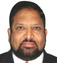
Dr. Rao S. Ramayanam
Vice President Sales, Middle East, Africa and South Asia, URTHECAST, Canada
About Speaker
Dr. Rao S. Ramayanam, is an accomplished senior executive in international sales, business development and marketing with more than 25 years of working experience in International companies and organizations including UrtheCast, DigitalGlobe, GeoEye, Space Imaging, The World Bank, APSRAC (India) and National Remote Sensing Center (India). He has developed several remote sensing applications and got the recommendations implemented at the grass root level for micro level planning, disaster management, drought management, irrigation using surface water resources, Ground water mapping and management, etc. He has been awarded the Astronautical Society of India award for his contributions to remote sensing applications. He has been supporting several customers including the government customers, oil & gas industry customers, construction & real estate industry and environmental industries spread across Middle East, Africa and South Asia. He is currently working as Vice President Middle East, Africa and South Asia for UrtheCast, a Canadian Space company, which has successfully installed two Earth Observation sensors on board the International Space Station (ISS) on to the Russian segment, Zvezda. UrtheCast has also finalized installation of the second generation cameras which include dual mode SAR and dual mode optical video camera on to the NASA segment of the ISS.
About Presentation
UrtheCast HD Videos, High Resolution Imagery and SAR Data from Space for Earth Observations
UrtheCast is a Canadian Space Company which has launched the First Generation earth observation cameras on to International Space Station (ISS), one of them being Ultra HD Video for the first time. UrtheCast has two earth Observations satellites in orbit, Deimos-1 (20m GSD) and Deimos-2 (75cm GSD). UrtheCast has designed a 16-satellite constellation consisting of 8 Dual Band (X and L) Synthetic Aperture Radar (SAR) satellites and 8 Dual Mode (Video/ Pushbroom) Optical satellites, to be built, launched, and operationalized in the 2019 & 2020 timeframe.
For the first time, these satellites will allow near simultaneous capture, with the same imaging geometry of dual-band SAR imagery and high-resolution optical imagery of locations of interest. The dual-band SAR will be the first space-borne sensor capable of imaging simultaneously in X and L bands. The dual-band SAR will have numerous imaging modes, including a SpotLight mode for high- resolution, StripMap mode, and ScanSAR mode in L-band to achieve a wide swath. The dual-band SAR will be able to image during day or night in any weather conditions and penetrate cloud cover.
The UrtheCast system will be able to take full advantage of the strengths that each of the individual sensors offers. This represents a truly novel platforms that will lead to significant advances in many other Earth Observation applications such as home land security, defence and intelligence, disaster management, environmental monitoring, energy and natural resources management, and humanitarian response, etc.
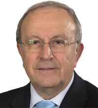
Prof. Orhan Altan
1st President of ISPRS
About Speaker
Orhan Altan was professor at the ISTANBUL TECHNİCAL UNIVERSITY retired in 2013; he was Head of the Department of Geodesy and Photogrammetry Between 1978 and 1980 he worked as liaison officer between ISPRS Commissions V and VII, in non-topographical applications of photogrammetry. He is member of the German Society for Photogrammetry and Remote Sensing and the Working Group "Close-Range Photogrammetry", and corresponding member of the German Geodetic Commission at the Bavarian Academy of Sciences.
He is the initiator and co-organizer of the symposium series "Turkish–German Joint Geodetic Days" since 1995. He is also member of the American and German Societies for Photogrammetry and Remote Sensing.
He is member of the UN expert group of the ad-hoc Committee of the UN Entity, SPIDER (Space-based Information for Disaster Management and Emergence Response) and chair of the JB GIS (Joint Board of Geospatial Information Societies) ad hoc Committee on Risk and Disaster Management. He is also Corresponding Member of the International Academy of Astronautics.
In the ISPRS Congress in Amsterdam he was elected as the Congress Director of the ISPRS Congress in 2004 in Istanbul. At the Congress in Istanbul in July 2004 he was elected as the Secretary General of ISPRS for the period 2004-2008. At the last ISPRS Congress in Beijing in 2008 he was elected as the President of ISPRS for the period 2008-2012. Since 2012 he works as 1st Vice President of ISPRS. In 2011 at the ICSU GA in Rome he was elected as an ordinary member of the ICSU Executive Board B; in 2014 he is once more elected to the ICSU EB. He was member of the ICSU finance committee and later from 2014 onwards chair of the Committee. He is working as committee member of the ICSU Ad-hoc Group of Experts on Disaster Risk Assessment.
He worked as "Guest Professor" in Stuttgart, Berlin, Munich Technical Universities (Germany) and ETH-Zurich (Switzerland) during the period 1990-2009 and published more than 170 papers in Turkish, German and English in Domestic and International Journals. He is editor or co-editor of more than 16 International Books.
He is widowed, has one daughter and one son.
Prof. Georg Gartner
President – International Cartographic Association, Austria
About Speaker
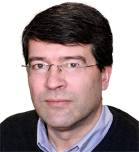
Georg Gartner is a Full Professor for Cartography at the Vienna University of Technology. He holds graduate qualifications in Geography and Cartography from the University of Vienna and received his Ph.D. and his Habilitation from the Vienna University of Technology. He was awarded a Fulbright grant to the USA and several research visiting fellowships. He is Dean for Academic Affairs for Geodesy and Geoinformation at Vienna University of Technology. He is Editor of the Book Series "Lecture Notes on Geoinformation and Cartography" by Springer and Editor of the "Journal on LBS" by Taylor & Francis. He serves currently as President of the International Cartographic Association.
Thomas Blaschke
Professor of Geoinformatics, University of Salzburg, Austria
About Speaker
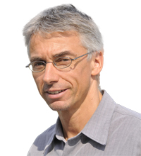
Thomas Blaschke is a Professor for Geoinformatics at the University of Salzburg, Austria, and head of the Research Studio iSPACE. His research interests include methodological issues of the integration of GIS and remote sensing for urban planning and environmental modelling, in particular integrating methods and domain knowledge into spatial analysis and GIS-based spatial decision support system. His academic record yields 330+ scientific publications including 100 journal publications. He is author, co-author or editor of 17 books and received several academic awards including the Christian-Doppler Prize 1995. He is also entrepreneur and co-founder of Spatial Services GmbH, a spin-off company of the University of Salzburg.
Abdullah Al Osaimi
GIS Manager – Ministry of Electricity & Water
About Speaker
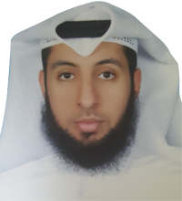
Abdullah Alosaimi, Section head in the IT department at the Ministry of Electricity & Water and is the lead GIS project manager at the ministry. With more than 12 years' experience working at MEW, he understands the ministry's business requirements and how GIS empowers the strategy and objectives for MEW's advancement.
About Presentation
Strategic Alignment to Meet Increasing Demand: Kuwait MEW's Story
With over 4 million consumers to serve, Kuwait's Ministry of Electricity & Water utilizes desktop, web and mobile application to plan, operate and maintain its networks allowing for future expansion with minimal to none challenges. The speaker will highlight how MEW used underground and overhead data to implement its GIS project including integration with existing systems such as SCADA, AMR and CRM. In addition to its ability to incorporate information with other government entities using GIS.

Andy Wilson
Director Strategic Business Development, Ordnance Survey International, UK
About Speaker
Andy Wilson is Director Strategic Business Development for Ordnance Survey International, a subsidiary of Britain's National Mapping Agency, and provides advice to government agencies in Europe and across the Middle East and South East Asia. He focusses on government spatial agreements, and how these deliver economic, environmental and citizen benefits.
He has over 25 years' experience in the Geographic Information Industry, starting his early career as a surveyor with Ordnance Survey and then progressing to Head of Public Sector. During this time he was responsible for developing and implementing the Public Sector Mapping Agreement for Great Britain which brought together over 3500 organisations under a single contract to all use the same spatial data under a common spatial reference system.
He is also a member of the Chartered Management Institute.
About Presentation
"The best resilience decisions come from spatially connected government"
To ensure the best possible policy decisions are made by Government, it is essential that key evidence from a variety of organisations across the public sector is easily and readily available by decision and policy makers to achieve that aim. Ordnance Survey International will explain how this has been achieved by implementing a comprehensive spatial data agreement and referencing standard across the whole of the British Public Sector. We will show how many public sector organisations in Great Britain are already using the same spatial data and referencing to save millions of pounds for per year and make the best resilience decsions.
We will show specifically how this framework has enabled Ordnance Survey to; have supported the spatial resilence of the London 2012 Olympic and Paraolympic games and worked with the UK resilience authorities to develop and provide a national web based resilience service. This enables 1000s of users access to a common operating picture and symbology using web maps and tools to respond and plan for emergency events. In addition we will show how common data access, standards and sharing information between different emergency responders has ensured a police vehicle, a fire vehicle and ambulance are all routed to the same precise location without delay.
Hussein Harahsheh
General Manager,Global Scan Technologies, Dubai, UAE
About Speaker
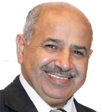
Hussein Harahsheh is a Geo-information Scientist, currently General Manager at Global Scan Technologies in Dubai. He started his carrier, in 1986, as a research scientist and projects manager in the field of Remote Sensing and GIS at the Royal Jordanian Geographic Center, then he was appointed as assistant Professor at United Arab Emirates University. Harahsheh holds a diploma of Civil Engineering from France in 1986 and a PhD on "Remote Sensing and GIS applications" from Japan in 2000. Based on long experience of optical and radar image processing and analysis, his research interests focus on remote sensing and GIS applications for natural resources environment analysis and monitoring, with focus on Oil spill, Land use Land cover, agriculture and vegetation studies, and Land degradation and desertification. He participated in many regional and international research programs. He has several publications in international reviewed journal. He shared the publication of several remote sensing and GIS related books, and participated as speaker in many International Conferences.
About Presentation
The use of KOMPSAT5 SAR Imagery for oil spill detection and monitoring
The Abu Dhabi Government endorsed vision for the Maritime Strategy for the Emirate of Abu Dhabi 'A safe, secure and sustainable maritime domain for Abu Dhabi'. This research study share this vision using the concept of monitoring as tool for marine protection against any possible oil pollution. The best technology to detect and monitor oil pollution and in particularly oil spill is "Syntactic Aperture Radar-SAR". In this case study we chose KOMPSAT-5 SAR, the Korean SAR satellite launched on August 2013.
KOMPSAT constellation is a unique combination of VHR optical data and SAR data, including KOMPSAT-2, KOMPSAT-3 and KOMPSAT-5. KOMPSAT-5 carries Xband synthetic aperture radar (SAR) for earth observation, and is capable of day-andnight imaging under all weather condition. It provides three operation modes: High Resolution Mode (spotlight mode) to provide 1 m resolution with 5 km by 5 km swath, Standard Mode (strip mode) to provide 3 m resolution with 30 km swath and Wide Swath Mode (ScanSAR mode) to provide 20 m resolution with 100 km swath at 550 km altitude, with four modes of polarization. KOMPSAT-5 provides products for various applications such as security and defense, image interpretation, mapping, land and natural resource management, environmental monitoring, disaster monitoring and more. For our case study we chose to work with Wide Swath mode (WS) with Vertical polarization (VV) to cover a wide area of interest located to the north west of Abu Dhabi including some important islands like "Zirku Island", and areas with oil production activities.
The results of data acquired on 4th May 2015 show some spot of oil spill with length estimated about 3 KM, and the daily satellite data acquisition over the period July 24 through July 31 shows serious and many oil spill events some are small, but many others are considered to be big with area size around 20 km2.

Prof. Martin Breunig
Chair of Geoinformatics, Karlsruhe Institute of Technology, Germany
About Speaker
Martin Breunig obtained his diploma in Computer Science from the Technical University of Darmstadt, Germany, in 1989. 1990-2000 he was member of the geo-database groups at Technical University of Darmstadt, Freie Universität Berlin, and Bonn University, Germany. In 1995 and 2000, respectively, he obtained his Ph.D. and habilitation at Bonn University. From 1995-2000 he was a member of the execute board at the Special Research Centre 350 at Bonn University. 2000 - 2010 he was professor for Geoinformatics at Vechta University and University of Osnabrück leading as director the Institute for Environmental Sciences 2002 - 2003. He directed several researcher groups funded by the German Research Foundation (DFG) and the German Ministry of Education and Research (BMBF). Since 2000 Martin Breunig was guest professor and visiting researcher at Ecole Nationale Supérieure de Géologie Nancy France, ETH Zürich, University of Vienna, Staffordshire University (UK), Russian Academy of Sciences St. Petersburg, and American University in Dubai (AUD). Since October 2010 he heads the Chair of Geoinformatics at Karlsruhe Institute of Technology (KIT), Germany. Since 2012 he is Dean [educ.] at KIT for Geodesy and Geoinformatics at the Faculty for Civil Engineering-, Geo- and Environmental Sciences.
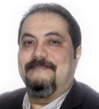
Dr. Mohamed MR Mostafa
President, Navmatica ME, Dubai, UAE
About Speaker
Dr. Mohamed M R Mostafa, president of Navmatica Middle East, completed his Ph.D. at the University of Calgary, Canada in 1999. He contributed to over 150 publications including the Manual of Photogrammetry and the ASPRS DEM Manual. His expertise include multi-sensor mobile mapping for Air, land, and Sea, as well as geodetic positioning. He served as the Vice president of the ISPRS Commission I from 2008 to 2012 and chaired the Direct Georeferencing Committee of The ASPRS from 2001 to 2010. He contributed to Conference organization in the USA, Canada, Italy, Germany, Switzerland, and China. He won 11 international awards in the last 21 years. He participated in many tutorials, seminars and workshops at the ISPRS and ASPRS over the last 20 years.
About Presentation
Indoor Mapping – State of the Art and New trends
Indoor Mapping is becoming a significant new application in the geospatial industry around the world. The multi-disciplinary geospatial technologies allow the integration of sensors now to produce systems capable of mapping the indoor environment of any type of building with high precision. On one hand, BIM includes a full design model of new buildings. BIM came a long way over the past few years and has been becoming a procedure in some parts of the world. On the other hand, Indoor mapping provides the as-built for any BIM. Indoor mapping helps now is many market verticals including, Security, Construction, and Oil & Gas. Currently, the typical attempts at indoor mapping are done using systems that include an imaging technology such as a laser or a camera. Such systems are almost obsolete due to the lack of resolution, precision and the long, inaccurate and tedious operation used in order to produce an indoor map. Such systems still exist in operation due to the typical market confusion that usually takes place when a new technology is born.
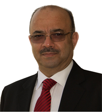
Prof. Mulhim Al-Doori
Professor of Computer Science, School of Engineering, American University in Dubai, UAE
About Speaker
Prof Al-Doori's personal and collaborative research mainly centers round developing and applying novel cognitive, computational intelligence and machine learning techniques to a range of complex real-world multi-modal application areas. More generally, he is interested in novel interdisciplinary research for mathematical modelling, analysis and control of complex systems – both theory and applications. Prof. Al-Doori has extensive industrial experience in design, development and administration of database management systems as a CEO of WINACOR Group – a leading UAE native software House, a Senior Systems Analyst for British companies and organizations such as Axiom Business Computers, Biwater ltd, Leicester Royal Infirmary Hospital, and Birmingham Royal Infirmary Hospital. He has also worked on numerous consultancy projects with internationally-recognized companies such as Oracle and Microsoft. He joined the American University in Dubai 2000, where is currently Professor of Computer Science and founding Director of the Gulf Geo-Informatics research Group. He has (co)authored/edited several Books and around 60 papers to-date in leading international journals and refereed Conference proceedings. He is a founding and academic liaison director of the British Computing Society middle east and Africa Chapter. Founder and moderator of the Database Operations and Development annual symposium 2010 -2014 and was Chair of the 9th International 3DGeoinfo conference 2014. He currently manages three funded doctoral research projects on 3D/4D Data and Model Management for Geosciences, as a member of the steering committee of the doctorate programme at Karlsruhe Institute of Technology- Germany as part of the AUD/KIT Geoinformatics group founded and established by Prof. Al-Doori. The group has already established active collaborations with leading researchers, including from TU Delft – Holland, Edinburgh University - U.K and is advancing internationally-leading and high-impact interdisciplinary research in Geoinformatics, with a focus on cognitive signal image processing, modeling and control techniques for enabling next generation healthcare and assistive technology, intelligent web and complex autonomous systems applications.
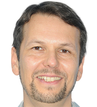
Carsten Roensdorf
Head of Advisory Services, Ordnance Survey International, UAE
About Speaker
Carsten Rönsdorf is Head of Advisory Services for Ordnance Survey International, a subsidiary of Britain's National Mapping Agency. He manages the Dubai office and provides geospatial and strategic advice to government agencies across the Middle East, specialising in in open standards, data sharing, 3D and future cities.
A geodesist by training, Carsten has been at Ordnance Survey for more than 12 years and was previously responsible for developing and managing Ordnance Survey's core data asset, the National Geographic Database, managing the product engineering group and providing consultancy to geospatial data users in government and utilities in Great Britain. Being involved in geospatial 3D since 1996, he has been leading the standardisation of the Open Geospatial Consortium's CityGML standard since 2007.
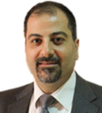
Dr. Adnan El Nasan
Chair and Associate Professor, Electrical and Computer, Engineering, American University in Dubai, UAE
About Speaker
Dr. Adnan El-Nasan received his B.Sc. in 1988, his M.S. in 1997, and his Ph.D. in Computer and System Engineering in 2003. Prior to joining AUD, Dr. El-Nasan was an Assistant Professor at the Department of Computer Engineering as well as an Assistant Dean at the Hijjawi Faculty for Engineering Technology at Yarmouk University in Jordan. While at Yarmouk University, Dr. El-Nasan helped setting up the Biomedical Engineering and Medical Informatics department. He was also an active board member of Yarmouk University's Academic Entrepreneurship Center of Excellence, where he was actively working on narrowing the gap between academia and industry as well as fostering innovation and entrepreneurship among students. During his 12 year tenure in the US, Dr. El-Nasan worked in the industry with a number of companies including the West Group, Thomson Publishing, and IBM Research. He has also held a number of visiting scholar positions at Iowa State University working on interdisciplinary research topics with the Center for Transportation Research and Education. Dr. El-Nasan's research interests include human-computer interaction (HCI), image processing, programming language design, medical informatics, classification, machine learning, content management and information retrieval.

Ahmed Nasir
GIS Unit, IT Dept, Sharjah Municipality, UAE
About Presentation
Sharjah Municipality Drainage data migration to smart maps.
E-services section of ITSD Sharjah Municipality took an initiative and with the decision of senior management, moved on to advanced software technology, in 2015, to achieve the result that was needed to keep track of all drainage utility network data and use it for quick and efficient analysis and to share it and make it visible on enterprise level.
The Drainage Department of Sharjah Municipality plays its part in keeping Sharjah Healthy. It seeks to make Sharjah an attractive green city where the treated waste water is used for irrigation, and hence preserving the drinking water.
All this is achieved through a vast network of utility lines laid across the city. To keep track of all that in a smart way means all pipes data to be readily available in a smart map form.

Paul Kuper
Research Associate, Karlsruhe Institute of Technology, Germany
About Speaker
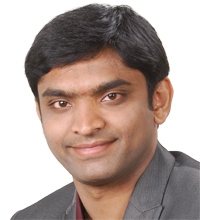
Paul Vincent Kuper obtained his Diploma in Systems Science with focus on Computer Sciences at the University of Osnabrück in 2010. Since 2011 he is working as a Research Associate at the Geodetic Institute of the Karlsruhe Institute of Technology (KIT) where he focuses on his PhD thesis and teaches several courses (i.a.: Geoinformatik A+B, Programming for Geodesists II, Geodatabases, etc.) . His major study interests include: mobile GIS, 3D/4D geodatabases, WebGL and GIS applications.
Prashanth Marpu
Assistant Professor -Water & Environmental Engineering, Program Masdar Institute Abu Dhabi, UAE
About Speaker
Dr. Prashanth Marpu is an assistant professor in the Water and Environmental Engineering Program at Masdar Institute. His specialization is in image processing, data mining, machine learning, remote sensing and GIS. Prior to joining Masdar Institute, Dr. Marpu was a researcher at the University of Iceland, Reykjavik, Iceland. Before that he was a Marie Curie Fellow at the University of Pavia, Italy working on developing advanced methods for hyperspectral data analysis. Dr. Marpu holds a PhD from Freiberg University of Mining and Technology, Freiberg Germany and MSc in Wireless Engineering from the Technical University of Denmark, Kongens Lyngby, Denmark. He has developed approaches for automatic change detection in multi-temporal remote sensing images, spectral-spatial classification of data and hyperspectral image processing.
About Presentation
Introduction to Remote Sensing
This short tutorial will introduce the basics of remote sensing technology and is aimed at beginners. The course will cover topics such as electromagnetic radiation, sensors, data acquisition, pre-processing, and data analysis methods such as classification, change detection and inversion. The course introduces a range of remote sensing tools and techniques used to address environmental issues at local, regional and global scales.
Damien Giolito
General Director, IMAO, France
About Speaker
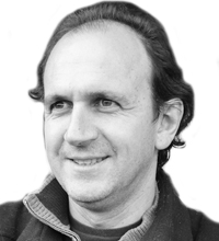
After passing his Civil Engineer Diploma in 1990, Damien GIOLITO spent 15 years managing buildings sites in the area of Paris France, mostly prestige project for French reputed clients, promoters and Architects. In 2000, he decided to reconvert in the field of aeronautics and pass the professional aircraft pilot exams. And then in 2004 he met with IMAO's president which was a small start-up in aerial survey with analogue photography. Since 2005 the company has developed, always in the data acquisition field, with Digital photography, lidar, oblique photography and 3D modelling for France. Since the beginning of the company, he dealt with operations, company structure and organization, technical and commercial development. He is at the basis of the creation of the biggest aerial photography camera in the world with 660Mpixels, and a unique integrated system for 3D model acquisition.
About Presentation
The B66, an answer for municipalities and smart cities
Booming cities require a fast update of their geographic data to manage their evolution constructively. Aware of the trade challenges, IMAO, a french company specialized in aerial data acquisition, created a revolutionary camera: the B66. In spring 2016, this camera, the largest on the market (660 Mpixels), will be used for the acquisition of Paris region (12 000 km2). Its speed of acquisition and processing make it a precious ally. Discover Paris region case study, the advantages of this camera (like no ATC controls because of the high flight) and how it can contribute to Middle East cities growth!
Dario Conforti
Worldwide Channel Partner Manager, Terrestrial Laser Scanner Products, Optech, Canada
About Speaker
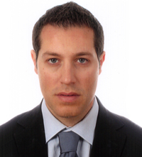
Dario Conforti joined Teledyne Optech in 2006 as a worldwide 3D Laser Scanner Specialist for land products. In 2010 he became Regional Sales Manager for Europe and Africa and in 2013 he become Worldwide Channel Partner Manager for all of Teledyne Optech's terrestrial products. Dario has extensive knowledge of GPS, bathymetry, and airborne photogrammetry, and over 13 years of experience in laser-scanner technology. He earned his degree in surveying at the Polytechnic University of Milan, where he studied cartography and photogrammetry.
About Presentation
Combined Laser/Multibeam Sonar Survey of Sydney Harbor
Teledyne Optech has been a world leader in the design, development and manufacture of advanced lidar instruments for over 40 years. In the last few years Teledyne Optech and its sister company Teledyne RESON have developed a full and seamless integration between their sensors, the motion-compensated ILRIS Terrestrial Laser Scanner and the SeaBat 7125 Sonar System, through the PDS 2000 software.
The ILRIS Motion Compensation (MC) option was developed to let surveyors use the normally static ILRIS dynamically by combining it with a Position and Orientation System (POS) and Global Positioning System (GPS) receivers. The resulting system is integrated into a mobile mapping platform and enables much more effective mapping in wide and complex terrain. This type of mobile laser scanning is now at the cutting edge of coastal survey technology because it allows surveyors to easily survey coastlines directly from a boat and is particularly useful for mapping long or inaccessible coastal areas.
This presentation will explain the integration of the ILRIS and SeaBat sensors and showcase several applications in the last few years from Europe to North America to Australia. The survey in Sydney, Australia is one of the most recent surveys performed and shows the perfect match between the underwater data from the sonar and the shore data collected by the lidar scanner. This presentation will also show other combined datasets from the Teledyne BlueView 3D Mechanical Scanning Sonar.
Zafar Ali
Project Analyst - Geospatial, Global Scan Technologies, UAE
About Speaker
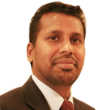
Zafar Ali Amanullah is a Senior Project Analyst - Geospatial with Global Scan Technologies, Belhasa Group of Companies, Dubai, UAE, since 2007. He obtained his Master Degree in Spatial Information Technologies, specialized on GIS and Remote Sensing from University of Madras. Overall he has 13 years of hands-on experience that included GIS and remote Sensing, Mobile and Static LiDAR data acquisition and cloud point post Processing, UAV-Aerial Photography, Managing GPS Surveying Team, R&D on Vehicle Tracking System, GIS Asset Management, Utility Management, Natural Resource Exploration, Oil & GAS sector, Research, Proposals, Evaluation, Accountable for Planning, Scheduling, Productivity & Progress monitoring, Reporting, Forecasting, Change Management, and Project Administration, Contract formulation, Monitoring the contractor's progress and performance to ensure goods or services confirm to the contract requirements. In addition, he supports research guidance to Masters, Engineering students and Ph.D Scholars. He has strong interpersonal skills, highly adept at diplomatically facilitating discussions, Recognized production and project management skills, and consistently met the needs of complex and managing large-scale projects.
About Presentation
THE LYNX LiDAR MOBILE MAPPER™ FOR POWER LINE CORRIDORS AND VOLUMETRIC ANALYSIS
Teledyne Optech's The Lynx Mobile Mapper™ surveying facilitates the collection of spatially correct data on a large scale. Optech mobile survey systems deliver high-accuracy engineering-grade survey data of transmission networks, power lines, and pipelines to map clearances, vegetation encroachment and asset condition. The Lynx SG has two 600-kHz sensors for survey-grade precision. It's the fastest, accurate, eye-safe lasers coupled to high-speed scanners with large fields of view, operate day or night to collect survey-grade measurements and most efficient mobile LiDAR mapping system available, with incredible detail and measurement rates of up to 1.2 million measurements per second. Collect engineering survey-grade LiDAR and image data from a vehicle at cruising speeds, while previewing the quality of your data in real-time 3D inside the vehicle. The ability to control several integrated cameras, including the Point Grey Ladybug®, adds further value to a system that is already considered the premium choice for mobile surveys where accuracy, precision and resolution are critical. A complete software solution includes best-in-class survey planning, project execution, inertial/position processing, LiDAR post-processing and information extraction. The Lynx SG leverages the LiDAR rectification power of Optech LMS Professional, which rectifies LiDAR data files to such a level of accuracy and quality that they require no further refinement, independent of the user. This minimizes processing time and maximizes efficiency while generating consistent results.
Global Scan Technologies (GST) is a Middle East representative of Teledyne Optech which is the world leader in the development and manufacture of advanced LiDAR and camera survey instruments for airborne, mobile and terrestrial mapping. Data has been collected in UAE and managed in power line corridors by providing more accurate geometric information of the power line assets along the corridors. Mapped, analyzed, integrated and updated with existing Base Map, find change detections and made Volumetric Analysis for power line corridors. We take advantage of LIDAR intensity and classified ground and non-ground points, power line feature extraction by statistically analyzed and transform is employed to detected power lines from the filtered object points. The results show the effectiveness of our methods and indicate that better results were obtained by using LIDAR intensity data.
Vivek Kale
Solutions Director, Bentley Systems, UAE
About Speaker
As a qualified Architect and Urban Designer, Vivek Kale practiced architecture for three years in India and four years of Urban Design in Middle East with Parsons HBA, before joining Bentley in 1998. He held technical positions for the building design and facilities management applications in MEA. He was the founder member of the regional MicroStation User Group, and a technology enthusiast for the 'built environment' for the past 20 years. He has been evangelizing Bentley's BIM (Building Information Modeling) applications for 17 years helping AEC firms evaluate and successfully implement design technology. Based in Dubai and covering the region, his responsibilities include educating, proposing and deploying Bentley's Solutions for 'Advancing Infrastructure' that add values to Designers, consultants Contractors and Owner operators.
About Presentation
BIM and GIS for Subsurface Engineering
"In cities around the world, the area that I believe poses the biggest risk to those designing, building, and operating infrastructure is found by looking down. It's also the area for which it seems there's been the least advancement of information modelling and information mobility to improve construction throughput and enhance the reliability, safety, and resilience of infrastructure assets." (Bentley Systems CEO, Greg Bentley). This presentation will look at the BIM and GIS technology for Smart Cities. The focus would be on Subsurface engineering, brings together data from multiple sources and then geo-coordinates it to allow effective sub-surface 3D Modelling, interactive inspection, utility conflict detection and clash resolution.
Talal Shawwa
Sales Director - Utilities, Bentley Systems, UAE
About Speaker
Talal Shawwa is Director - Utilities Sector for Bentley Systems - MENA region. He holds a Bachelor of Science in Business Administration and Finance, and has more than 23 years of experience in solution selling, business development, and channel management with international companies across the Middle East. Mr. Shawwa works directly with a number of utility owner operators to help improve the engineering infrastructure adoption. Talal is also on the Advisory Board of MENA Water Summit.
About Presentation
Reality Modelling For Utilities
This presentation demonstrates how Reality Modelling can turn photographs into a digital reality model for utility companies through a real-life example of a major French operator of a public electricity distribution network that covers over 95% of the continental French territory. In this case we turn photos taken from an old substation site into a digital reality model that has the potential to save hundreds of onsite visits, assist in Asset Management, help in Functional Indexing, check for failure modes, and add conceptual engineering designs on top of existing assets and sites.
Richard Budden
Business Development Manager for Transportation, Infrastructure and Smart Cities, Esri, UAE
About Speaker
Richard Budden is a Business Development Manager for Esri, focusing on smart cities, transportation and infrastructure. He studied at the University of Reading in the UK and in 2001 received a Bachelor of Science in Human and Physical Geography. He has over 12 years of experience in GIS and information management, and previously provided GIS consultancy and advice to clients as part of the geospatial team at UK design and engineering firm Atkins.
In 2011 Richard relocated to the Middle East where he has supported complex multidisciplinary projects for clients including the UAE Ministry of Public Works, Kuwait Municipality, Abu Dhabi Urban Planning Council and the Qatar Ministry of Municipality and Urban Planning. Richard has engaged with government clients and offered strategic advice that has contributed towards the development and implementation of national visions and smart cities.
In 2014 Richard joined Esri in Dubai and is responsible for the West Asia, Middle East and Africa region.
About Presentation
Smart Transportation for Smart Cities'
Peter Csörgits
Chief Engineer, Geodezia, Hungary
About Speaker
Peter Csorgits graduated at the Technical University of Budapest, Faculty of Civil Engineering. In 1991 he earned the MSc in Civil Engineering and Surveying. From 1991 to 1993 he participated on secondary training within a scholarship of the Hungarian Academy of Science at the Satellite Geodetic Observatory, Institute of Geodesy, Cartography and Remote Sensing, Penc, Hungary. He is a Licensed Surveyor (senior degree) since 2005, Expert of Geodesy since 2010. From 1993 to 1998 Peter worked as surveyor. Until 2002 he worked as senior sales manager for a company, which sells geodetic GPS instruments. From 2003 to 2007 he was the technical leader at Geofor Land- and Mine Surveying Ltd as Chief Engineer. From 2007 he worked as the Deputy Head of Surveying and GIS Department of Geodézia Zrt. In 2011 he was promoted to Head of Department. From 2013 he is Chief Engineer of Geodézia Zrt. His experiences include large scale mapping, GIS, reference point networks, GPS, cadastral measurements, photo interpretation, construction geodesy, and mobile mapping. Some large projects, which he participated as project manager are: Cadastral Mapping in Nógrád County, Hungary (2 500 sq. km); Inventory Map Renewal of the Hungarian Oil and GAS transportation network (10 000 km); MGCP – Military Topographic Map Database creation interpreting of 300 000 sq. km of satellite and aerial photos; Inventory- and Easement Mapping of Hungarian mid- and low voltage electric network (60 000 km); and Mapping of a few thousand km of road and railway wit Mobile Mapping System.
About Presentation
Past and future – Data collection technologies to provide precise data for GeoBIM and Smart Cities
Due to the fast growing demands of Smart Cities and GeoBIM related information and communication technologies and their need for the most up-to-date, comprehensive and precise data, surveying companies must revive their capabilities and technologies to serve the customers. There are lot of conventional technologies that can be used to provide accurate geometric data – and to a lesser extent to collect attribute data - but the most recent data collection instruments and technologies can attend to even the most demanding data claims. New devices can also be used from the air to provide as precise data collection as grounded instruments can. We can also provide subterranean information regarding public utilities with accuracy that matches conventional instruments but faster, with higher productivity and with better cost efficiency. My presentation would try to summarize the most promising and most recent data collection technologies, comparing them to conventional procedures. I will mention some interesting projects from our portfolio to substantiate the advantages of modern measuring instruments.
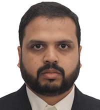
Mohd. Afroz
GIS, MOMRA, Saudi Arabia
About Speaker
Mohammed Afroz, working as a GIS Analyst for Deputy Ministry for Land and Survey, Ministry of Municipal and Rural Affairs (MOMRA), Riyadh, Saudi Arabia. Being Geo-Professional, involved in defining standards, and specification, induction and evaluation of new technologies, project defining and management and initiated many study and research projects.
About Presentation
Enhance Topographic Data by Terrestrial and Oblique Imagery
Geospatial Information is critically important. Municipal authorities rely on topographic data to support their day to day operations and decision making. To cope up the high rate of urban development, a study initiated to evaluate terrestrial imageries and oblique imageries to support the existing topographic map data.
Mike O'Boyle
National Security Business Development Manager, Esri, UK
About Speaker
Mike O'Boyle served in the British Royal Engineers from 1977 to 1993. He was the UK Exchange Officer to the US Defense Mapping Agency during the first Gulf War and participated in the US/UK programme which introduced the first fully digital end-to-end production system to US and UK Military Mapping Agencies. Mike's career since leaving the Army has ranged from technical Project Manager, System Engineer, Solution Architect to Account Manager, including assignments in Defence, Intelligence and Law Enforcement agencies. He has managed senior relationships in strategic accounts across the National Security community. Mike joined Esri Global Inc in December 2010 as Defense Business Development Manager, Middle East & Africa. He has a BSc in Civil Engineering and MSc in GIS.
About Presentation
'Building Safer Communities: Creating a more secure & resilient future'

Dr Saad A. AlMubayedh
Founder & CEO, THTC, Dubai, UAE
About Speaker
Dr AlMubayedh has been working in the area of IT in transportation for more than 30 years. He was a faculty member in King Fahd University of Petroleum & Minerals (KFUPM) in Dhahran, Saudi Arabia from 1991 till 2006, where he taught graduate courses, and conducting research in different areas in IT applications in Transportation, GIS, and related areas. In 1999, Dr Al Mubayedh founded THTC in Dubai to work on digital map making, navigation, and related areas. He pioneered the work on navigation in GCC countries and has provided consulting/advising services to a number of governmental and private agencies in GCC. Dr AlMubayedh obtained a B.S in Civil Engineering form KFUPM in Dhahran Saudi Arabia in 1981, a Master of Science in Civil Engineering (Transportation), 1984 and a Master of Urban Planning (MUP), 1985 from the University of Washington, Seattle, Washington (USA), and a Ph.D. in Civil Engineering (Transportation Planning), 1991 from Northwestern University, Evanston, Illinois (USA).
About Presentation
Real Time Traffic in ME
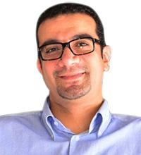
Ahmed Taha
Application Engineer - Utilities and Mapping, Bentley Systems, UAE
About Presentation
Reality Modelling for Smarter Cities
Making a city smarter is a considerable challenge facing us all today. But imagine capturing the reality of existing conditions and quickly developing detailed 3D models for engineering purposes for the use in design, construction or operations. Imagine you could do this from simple photographs, automatically meshed together. This is now the reality and the breakthrough technology from Bentley Systems which will be explored in this presentation to bring reality modeling to life by ensuring those responsible for making cities smarter can do this with unique technology. See how simulation can add real-world context to cities and engineering workflows can be applied to these 3D models.
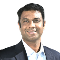
Prof. Praveen Maghelal
Masdar Institute, UAE
About Speaker
Dr. Praveen Maghelal has in interdisciplinary background with PhD in Urban and Regional Sciences from Texas A&M University, Masters in Infrastructure Planning from New Jersey Institute of Technology, and has Bachelors in Architecture and Diploma in Civil Engineering from India. His research interest includes sustainable community planning through sustainable transportation. He has been involved in several research projects that investigated the built-environment for its impact on safe and sustainable transportation. His dissertation quantified the built-environment and investigates the role of its constructs on walking to transit station and was funded by the Active Living Research Dissertation Grant through The Robert Wood Johnson Foundation. He was a co-investigator in analyzing the relationship of Land-Use, Infrastructure and Transportation Network for the Broward County and has published several articles on sustainable transportation. He also investigated the role of developments around transit station in Dallas, Texas in making the region and the stations a magnet for sustainable development in future.
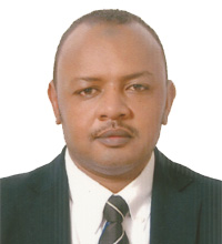
El Moiz Abdalla El Amin
GIS Section, Sharjah Electricity & Water Authority, UAE
About Speaker
El Moiz Al Amin has been working in Sharjah Electricity and Water Authority since 1998 and is one of the GIS section founders at SEWA 2001. More than 15 years' experience in GIS projects implementation and managing at various levels for Government Utilities sector, engineering firms and Utilities using ESRI Software. Specialties in Town and cities planning , web GIS implementation, administration, project planning, project goal definition, data conversion and migration, field data collection and attribution, providing Map production, geo-database modelling and design, Geo processing, spatial analysis and QA/QC. He holds more than 95 certificates in GIS & international GIS events and workshops.
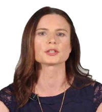
Chrystelle Ourzik
Business Development Manager, Esri, UAE
About Speaker
Chrystelle Ourzik has 15 years' experience in the field of GIS and Remote Sensing. Ms. Ourzik has worked with many Utility and Telecom companies around the world (Americas, Europe, Africa and Middle-East) helping them to understand how mapping and GIS can truly be transformational for their organization. Ms Ourzik is passionate about the impact that technology and GIS can bring to the table. She loves to tell and hear successful stories about customers that made the decision to get their workforce more engaged and connected in their daily work using maps and location analytical information at work. Ms Ourzik is now the WAMEA Utilities and Telecom Business Development Manager for ESRI Inc. She earned a MSc in Remote Sensing in 1995 at the University College of London.

Richard Budden
Business Development Manager, Transportation and Infrastructure, WAMEA region, Dubai, UAE
About Speaker
Richard Budden is a Business Development Manager for Esri, focusing on smart cities, transportation and infrastructure. He studied at the University of Reading in the UK and in 2001 received a Bachelor of Science in Human and Physical Geography. He has over 12 years of experience in GIS and information management, and previously provided GIS consultancy and advice to clients as part of the geospatial team at UK design and engineering firm Atkins.
In 2011 Richard relocated to the Middle East where he has supported complex multidisciplinary projects for clients including the UAE Ministry of Public Works, Kuwait Municipality, Abu Dhabi Urban Planning Council and the Qatar Ministry of Municipality and Urban Planning. Richard has engaged with government clients and offered strategic advice that has contributed towards the development and implementation of national visions and smart cities.
In 2014 Richard joined Esri in Dubai and is responsible for the West Asia, Middle East and Africa region.
About Presentation
Smart Transportation for Smart Cities'
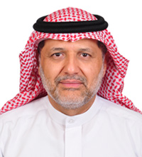
Dr. Saad A. AlMubayedh
Founder & CEO, THTC, UAE
About Speaker
Dr AlMubayedh has been working in the area of IT in transportation for more than 30 years. He was a faculty member in King Fahd University of Petroleum & Minerals (KFUPM) in Dhahran, Saudi Arabia from 1991 till 2006, where he taught graduate courses, and conducting research in different areas in IT applications in Transportation, GIS, and related areas. In 1999, Dr Al Mubayedh founded THTC in Dubai to work on digital map making, navigation, and related areas. He pioneered the work on navigation in GCC countries and has provided consulting/advising services to a number of governmental and private agencies in GCC. Dr AlMubayedh obtained a B.S in Civil Engineering form KFUPM in Dhahran Saudi Arabia in 1981, a Master of Science in Civil Engineering (Transportation), 1984 and a Master of Urban Planning (MUP), 1985 from the University of Washington, Seattle, Washington (USA), and a Ph.D. in Civil Engineering (Transportation Planning), 1991 from Northwestern University, Evanston, Illinois (USA).
About Presentation
Real-Time & Historical Traffic Info: Successful Deployments in GCC

Eman Al Tunaiji
Engineer, Applications Development and Analysis, MBRSC, UAE
About Presentation
Smart Application for Feature extraction and 3D modeling using high resolution satellite Imagery (SAFIIY) Project
Since the launch of DubaiSat-2 (DS-2), the second earth observation satellite developed and owned by Emirates Institution for Advanced Science and Technology (EIAST), on 21st of November 2013, it had been used widely across governmental entities in United Arab Emirates (UAE) for numerous purposes that include, but not limited to project development monitoring, environmental studies, and site surveying. SAFIY Project aims to develop an application that utilizes DS-2 products that are already familiar to government users, to detect specific types of features that fall under the following categories: Buildings and Houses, Road Networks, Water Areas, and Vegetation Areas. Mapping of these features brings a huge benefit as it facilitates many governmental routine tasks. The project is collaboration with Deimos Space UK Ltd where the company is a wholly owned subsidiary of Elecnor Deimos created in 2013 to address the UK market for space systems, services and applications. Deimos Space UK offers expertise in the mission and flight engineering, ground segment systems, flight software systems, ground segment systems and more. This collaboration will be a great opportunity for UAE team to work with European experts in the field of satellite image applications development. UAE team will share experience and knowledge and gain new experiences from this collaboration which will improve their capabilities and technical skills.
In general, using earth observation satellites that have a temporal resolution of 2-5 days is helpful as it reduces the need for ground-based inspections. Thus governmental processes can be processed faster with reduced cost and it will allow resources that were utilized for manual and routine work to be utilized elsewhere in a more productive manner. Moreover, this application helps UAE governments to be smart by utilizing smart solutions, and space-based technologies to improve their efficiency and reduce the administrative burden on people and businesses. SAFIY project uses image processing algorithms to extract features from the satellite images. Although feature extraction methodologies and algorithms are widely used and are considered as an active research area, the project is considered unique and innovative in the sense that it applies feature extraction and 3D modelling algorithms to benefit governmental entities and to speed their processes.
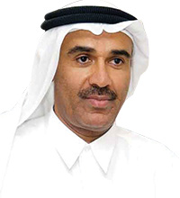
H.E. Eng Hussain Nasser Lootah
Director General
Dubai Municipality
UAE
Signing Ceremony between Fujairah Municipality and Dubai Municipality CubeSat Launch ceremony by Dubai Municipality and Mohamed Bin Rashid Space Centre Signing Ceremony between Etisalat and Dubai Municipality
- Signing Ceremony between Fujairah Municipality and Dubai Municipality
- CubeSat Launch ceremony by Dubai Municipality and Mohamed Bin Rashid Space Centre
- Signing Ceremony between Etisalat and Dubai Municipality